| Weather: Sunny and warm with a light, following wind |
| Distance covered today: 23.2km ( 14.4mi) |
| Last night's B&B: Cookes of Cley |
| % Complete: Cumulative distance: 100%: 166.4km |
| GPS satellite track of today's route: Day 8 (click!) |
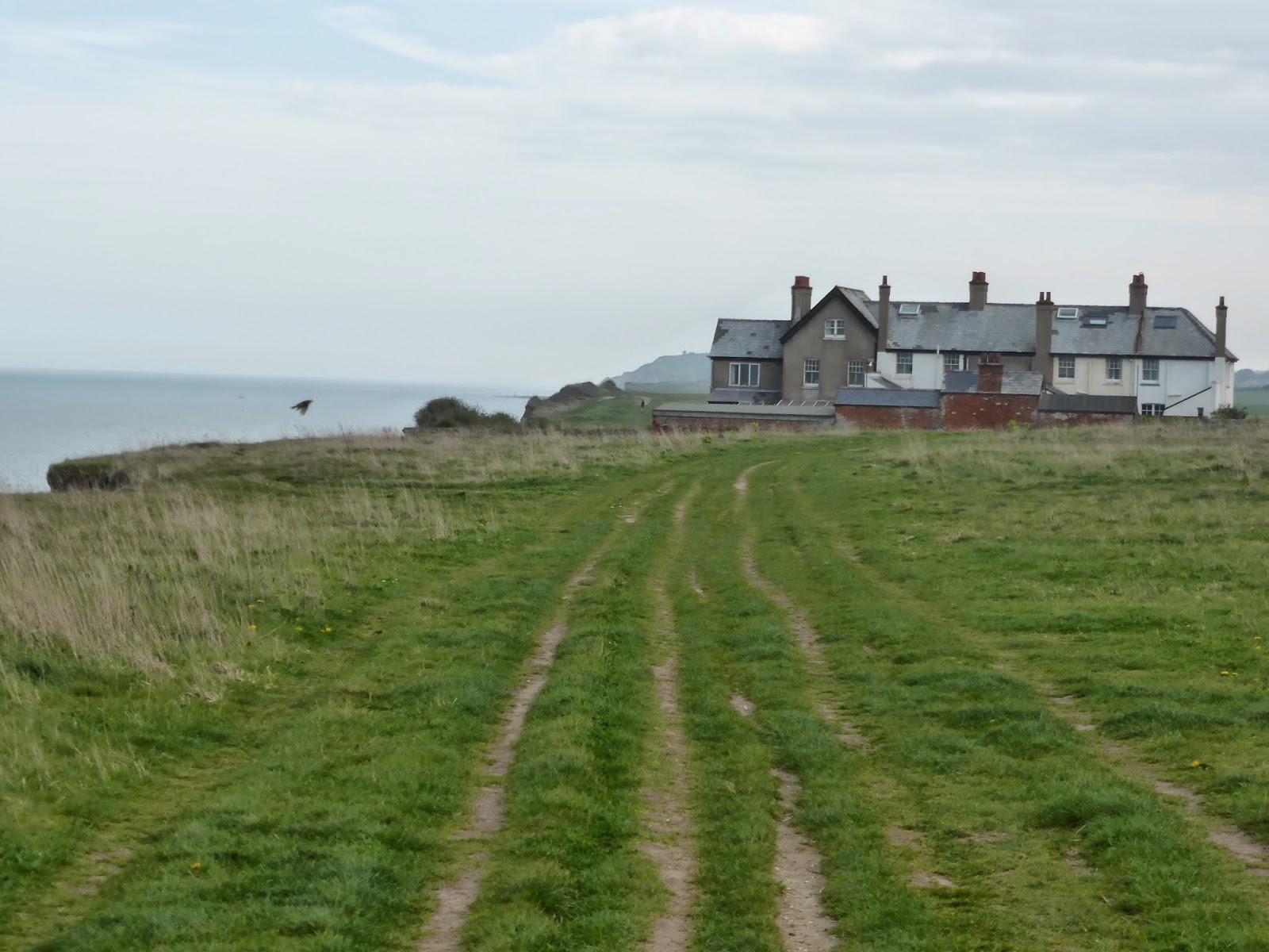
Peddars Way and the Norfolk Coast Path is a walk for the cognoscenti. True, it is in the main flat, (though today's walk provided something of a surprise with a slight sting in the tail), short (the shortest to date) and the weather is likely to be as good as may be experienced anywhere in these islands. The going is generally very good, though again, today was in part an exception. The path is very well maintained (storm surges permitting) and signed. However, compared to what is on offer on any of the other national trails in my experience, it is just a bit ho-hum.
That is, unless you are interested in birds. I had vaguely realised that this was a bird-watchers paradise, but I hadn't realised the extent of it. As an example, the sighting of a North-American white-crowned sparrow in 2008 attracted thousands of visitors, and their charitable donations paid for restoration of a stained-glass window in a local church, where the famous sparrow is now depicted. I remember on Hadrian's wall, describing the somewhat intellectual walkers with their reference books and their high foreheads. I contrasted them with the Pennine Way walkers (the paths overlap at this point), with our Neanderthalic receding brows and our wild, staring eyes. Indeed, the walkers of Norfolk Coast are just as distinguishable! They too have their reference books, and the quiet and unobtrusive manner of the intellectual nature lover. The average age is far higher, and from the conversation, these people visit multiple times. There are many second homes in the pretty villages near the coast, occupied, I understand, in the main by birders. Cley Marshes is one of the foremost bird reserves in the country and the path along the East Bank has been called 'the most famous bird walk in Britain'. Of course hardly any of these people actually walk the entire coastal path, let alone the lonely Peddars Way; on my travels, I met only one person doing so.
The other fascination is the constant shifting and erosion of the coast. On my way, I learned that the Environment Agency, the National Trust and locally the Norfolk Coast Partnership have changed their policy with respect to coastal erosion. The impact of climate change is such that the country can no longer afford to defend against all coastal erosion, and so a choice must be made. The authorities are defining areas where a determined effort will be made to resist the sea, and for the rest, the sea will just be left to get on with it. On the North Norfolk coast, there is a growing acceptance of the area as a "naturally functioning coastline". Of course, there will be losers, and the policy will always be controversial. No doubt, the politicians will meddle with it on occasion, as they did this year on the Somerset Levels, but a walk along this coast shows quite clearly that the policy is not just sensible. There just isn't a credible alternative. Even the spectacle of houses falling into the sea is overblown by the media: the Environment Agency estimates that "200 homes are at risk of complete loss to coastal erosion in the next 20 years". This is serious, especially for the owners, but given that there are 20-25 million houses in the UK, it is not critical. On the other hand, the white cliffs of Dover will stay white and more topically, the beautiful Hunstanton Formation will remain magnificently red!
The constant shifting of the coastline has uncovered other important finds, which include the bones and teeth of hippopotamus, hyena and even the Etruscan rhinoceros! In 1990 the 85% complete skeleton of a 5 metre tall elephant was discovered and in 2005, flint flakes worked by early man were found that push back the date of the first recorded human activity in Britain to 840,000 years ago.
Not of course that I discovered any of these things, though I was told, interestingly, to keep my eyes open for the flint flakes, just as I had been in Pembrokeshire. The last day of my walk was not without its challenges, the most notable being a 5 mile (8km) hike along the shingle beach from Cley Eye to Weybourne Hope. This was more challenging in places than walking in soft sand, and I sustained the only injury of my trip; a pulled muscle on my shin, but the sound of the sea and the fact that in places I had the entire coastline to myself was great consolation (no-one else was stupid enough to trek along the coast!). I had a delightful tea-break in an ancient tea-room in Sheringham, populated by very old people, one of whom, wearing very dark sunglasses indoors for some reason, accosted me and explained her war in London, where as a teenager, she had romped amid the bombed-out buildings and watched the nightly pyrotechnics, to the great displeasure of her parents, but with numerous friends and relations. Her parents had moved out of London to Coventry, but when that was bombed, they decided to return to London, because one might as well be happy and one was at risk everywhere!
The final stretch included an unexpected climb to the highest point in Norfolk, albeit only 105 metres (350 ft) through wooded plantations amidst numerous caravan parks, followed by a gradual descent into Cromer and a somewhat ant-climactic end of walk. I had expected a plaque or something on the Cromer Pier to signal the end, but when I spoke to the woman running the lifeboat centre at the end of the pier, she knew nothing about it; hadn't even heard of the walk! Eventually, I found a lamppost with a national trail acorn on it showing the distance to Hunstanton, and I decided that would have to do. Meanwhile, poor Veronica had been held up in traffic, so I pounced on a passing stranger, asked her to take my picture, and headed for yet another tea-room.
The blue numbered pushpins show the start and end of each days walk
Even the one wet day was really only drizzly for the first hour. Walking conditions could not have been better and I enjoyed a following wind the entire trip
I suspect the GPS satnav slightly overdoes these altitude stats, but this is what it says!
This is more accurate. The length of the path is about the same as the Cotswold Way
Ditto in miles

A WW2 turret near Cley. There was evidence all over of coastal defences, though most are disappearing as the coastline changes

The start of the shingle shoreline

I met a family composing a birthday card on the beach amidst great hilarity and industry. A photo would be taken by smartphone camera and sent to the recipient elsewhere

The shingle banks; each layer shaped by a storm. Not easy walking!

"He who would old England win, must at Weybourne Hoop begin". Apparently the shape of the coastline here allows deep-draught boats to anchor close inshore, and this has bred invasion scares for centuries, along with much military presence, from Elizabethan times onwards. The Muckleburgh Military Collection is now one of the largest private displays of military equipment in Britain

Beyond Weybourne, the cliffs start to rise for the first time since Hunstanton, and the evidence of constant erosion is clear
The path used to run in front of this house; now it has been diverted to the rear. The house is still occupied but it must be one of the 200 houses in Britain threatened by the sea.

Erosion taking recent chunks out of the coastal path, Do not approach the edge!

An African squatter camp in England? No, those are huts on allotments!

A thin blue line separates the golfers from the walkers. (Actually, it is just the out-of-bounds marker!)

The North Norfolk Railway, a preserved steam railway, connecting Sheringham with Weybourne and Holt. The sound of its whistle was so redolent of my youth, on the way to school in Grahamstown.

In Sheringham, determined efforts to shore up the coastline against the sea, using great slabs of highly reinforced concrete, in pursuance of the new policy. Here we stand!

The first swimmers I have seen all trip. They looked frozen!

This was the old lady who told me about her war years in that strange little tea-room

These Shetland Ponies are in a horse sanctuary; they looked well cared for, but are nevertheless a reminder of the stupid sentimentality that pervades the attitudes towards horses in this country. Old horses should be put down and eaten. I agree with Veronica and Princess Anne!!

Just visible, shimmering on the horizon, the Sheringham Shoal Wind Farm, 317 MW of capacity (10% of the capacity of a large coal-fired plant), but almost unobtrusive in its place

Country walking through the woods to Cromer

Cromer Church - a cathedral to any other!

No plaque at the end of the pier, just a funny photo op. In retrospect, I should have stuck myself in the middle hole!

The elegant Cromer Pier. Too bad about the seaside tat!

At least the Hotel de Paris looks the part!

At last I found a lamppost indicating the start of the trail, because it is indeed 47 miles by trail to Hunstanton

So I had a passer-by take a snap. Job done....
King Canute also tried to turn back coastal erosion. Lets hope the Environment Agency has more success in their selected localities! Most interesting that the erosion has unearthed hippo, hyena, rhino and elephant remains. I had absolutely no idea that these creatures once roamed where you now roam!
ReplyDeleteYou do look fit and well and happy... good luck with the op.
Interestingly, Canute is said to have set his chair in front of the rising tide in Southampton, where yours and my invasion of England started some 40 years ago! Thank you again for all your comments. It has been most gratifying to see your entries every morning first thing on my travels. Most inspirational!
DeleteKevin,
ReplyDeleteCongratulations on completing the walk, even if you found the path level and it lacked a Real Challenge... but think of all the sea air in a Boy's Lungs, you'll now be as fit as a fiddle and ready even for Ogden.
AND... you 'specially went and found a bit of my DNA... at least as summarised by you! Steam! A splendid photo... and it was travelling from Holt! And yesterday, I was at Peterborough with all the Old Toppies at the Annual Model Steam Railway Fest, which you have visited with me in the past, and had a whale of a time observing the extremely serious business of the English at play... I am afraid I have bought some more bits and pieces that need assembling, want a couple of coaches to build?
Here at Peatmoor, there has been much enjoyment of the Blog and the descriptions of the trip... the only thing we have missed are your usual comments on the B&Bs... but we surmise that the English Tourist Board threatened to ban you if you didn't desist, as your comments were not encouraging the Americans...
Glad you are safely home, and see you next week.
Chris
Chris,
DeleteThank you for your very kind comments, and you'll be unsurprised that I did unearth another nugget with particular reference to your DNA. I learned that the inhabitants of Sheringham are known as Shannocks, which derives from the word "shanny", which is apparently a word in the local dialect meaning "unruly". Now, if I have ever met a man less deserving of the epithet "unruly", it is you, which starts to cast doubt on all your ancestor research!! Although, on reflection, given your attitudes towards the political establishment, perhaps I am mistaken?!
Congratulations Kevin. Now to get the next hurdle out of the way and then you can think about entertaining us all with another blog next year!!You deserve a great big X!
ReplyDelete